|
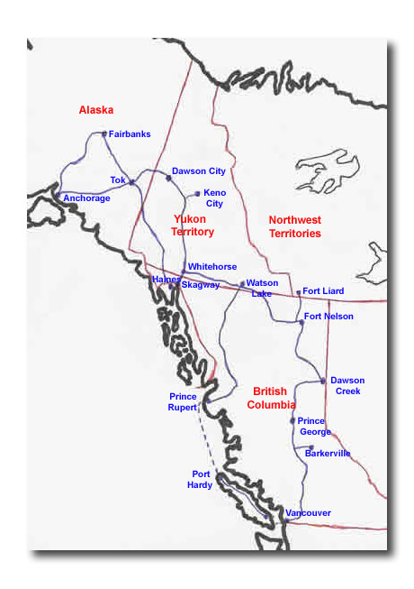
Sunday, August 1 -– Fairbanks Following Mass this morning, took a day trip, first visiting a viewing station for the Alaska Pipeline, one of the largest pipeline systems in the world, and from an engineering perspective, one of the most complex. At a cost of $8 billion, it was the largest privately funded construction project in the world. The 800-mile long pipeline stretches from Prudhoe Bay on Alaska’s North Slope, through some of the harshest terrains in the world, to Valdez, the northernmost ice-free port in North America. Oil traveling through the 48-inch pipeline at 4mph takes about 8-1/2 days to reach Valdez. When the oil enters the pipeline at Prudhoe Bay, its temperature is 116 degree F. It cools to about 65 degrees by the time it gets to Valdez. To prevent melting of permafrost, the pipeline is insulated when below ground (about half the length of the pipeline is below ground), and by heat transfer pipes and radiators when above ground. When above ground, the minimum clearance is 5 feet, allowing caribou and other animals to migrate uninhibited. Devices called pigs are sent through the pipeline every 4-6 weeks to clean interior pipe walls and survey the interior pipe shape. Any anomalies could be corrosion sites requiring repair. Most fascinating to see is that the pipeline is built in a zig-zag pattern. With temperatures ranging from +80 F to -80F, expansion and contraction of the metal is an inevitability. The supports holding the pipeline are designed to allow the pipeline sections to move up to 12 feet, and a further 2 feet in the event of an earthquake up to a magnitude of 8.5 on the Richter scale. To give you an idea of the magnitude of oil interests, the pipeline delivers about 1 million barrels of oil per day. One barrel equals 42 US gallons, yielding 18 gallons of gasoline, 10 gallons kerosene, 5 gallons fuel oil, 3 gallons jet fuel, 2 gallons lube oil/asphalt/wax, 2 gallons chemicals for manufacturing, and 2 gallons for other products. It was fascinating to see the pipeline and to learn so much about it in a short time. From modern-day technology we then went to obsolete technology with a visit to a Gold Dredge. An ingenious 5-deck, 250-foot long floating mechanical contraption in operation from 1928 to 1959, it extracted 7-1/2 million ounces of gold, moving only 4 miles over all those years. At the front is a gantry that raises and lowers a line of buckets to scoop gravel from the river bank. The buckets dump their payload of gravel into a hopper that feeds a cylindrical screen that is washed with water. Lighter gravel washes out the bottom of the screen onto a conveyor belt held up by the rear gantry, which expels the gravel out the back. The heavier gold drops through the screen onto riffled collection beds. The dredge worked around the clock, stopping every two weeks for four hours to collect the gold from the collection beds. U.S. Marshalls armed with shotguns stood watch while all hands loaded the gold into strongboxes. Starting to get a taste for gold, we then went to the El Dorado Gold Mine. A working placer mine, the visit started with a short trip on a narrow gauge railroad that went through a permafrost tunnel. Inside the tunnel, the train stopped so we could see the layers of permafrost and bedrock. In wintertime, when the ground outside was frozen, mining operations worked below ground. Using steam to thaw the ground, gravel was loaded into carts and loaded into buckets. There was a demonstration of a steam donkey raising these buckets of gravel from under ground and transporting them along lines to be dumped in a large pile. In the spring, this pile would then be washed with a hydraulic pump to wash out the large gravel, while the rest would then go into a sluice box to capture the gold. We visited the working mine, using the same basic techniques used historically, but with modern refinements and labour-saving machinery. A bull dozer moves the earth around, a back hoe loads gravel into a large hopper. Water rushes into the hopper, washing the gravel down a 3-foot wide, 50-foot long sluice box. The sluice box is low-walled, with iron mesh on top of astro-turf on the bottom. The larger gravel washes right down the sluice and out the other end, while sand and small gravel is caught in the mesh. Fine particles of gold are caught in the astro-turf. The gravel is then panned using a gold pan. Each of the people on the tour was given a bag of dirt and a gold pan and taught how to pan gold. My pan had 76 pieces of gold, weighing 10 grams, worth about $20. I was told that this was a very good pan, perhaps partially attributable to my previous panning experience which I will tell you about in a few days. The five of us collectively panned about $40 worth of gold. Needless to say, this was a lot of fun! They had on display a 19-ounce, $25,000 gold nugget which each of us got a chance to hold. The husband and wife owners really put on a show, too. The wife said that we had to learn proper pronunciation – this was a “gold – MINE”. As we left, she said to Patrick, “Now remember. For Christmas – a bulldozer and a front end loader.” Visions of gold in our minds, we decided to soak it out at Chena Hot Springs. This was a natural mineral 146-degree F hot springs with indoor and outdoor pools. A nice way to end the day. For Fairbanks photos, click here. Monday, August 2 – Fairbanks to Tok One display that was really fascinating was on the Aleuts, the natives who live on the Aleutian Islands, which stretch far out into the Pacific from mainland Alaska. Because of their location, during the World War II they were strategically important. From there, Japan could easily attack the west coast of North America. Everybody has heard of Pearl Harbour, but few have heard the story of the Aleutian Islands during the war. Japan did attack and hold part of the Aleutians for a few months in 1942-43 before being liberated by American troops. In the course of it, though, the Aleuts were uprooted and sent to the lower 48, some with as little as 26 minutes notice before the troops burned the homes and the church so that the Japanese couldn’t use them. For the Aleuts, their memories went up in smoke before their eyes – a tragic untold story in American history. Before we left Fairbanks, we stopped at the Visitor Center which has a milepost signifying the “real” end of the Alaska Highway. The actual end is at Delta Junction, about 100 miles south, but on a map, logically one would think the end to be at Fairbanks. Visitors to the Visitor Center park in the parking lot of Immaculate Conception Church. We stopped inside and found a stained glass window dedicated to our friends, the Hoffmans. On our way again, we stopped briefly at North Pole and Santaland. Yes, it’s true! And some of Santa’s reindeer were there, too. Some of our friends with small children can expect a postcard from Santaland, with a postal stamp from North Pole proving that we were actually there. Last stop before Tok was at Delta Junction. This is the acknowledged end of the Alaska Highway, notwithstanding Fairbanks’ claims, so we took our pictures (even Duncan) in front of the “End of the Alaska Highway” Mile 1423 milepost. For us, as we’re traveling it backwards, it marked the beginning. For Fairbanks to Tok photos, click here. |
Fairbanks to Tok
For Fairbanks to Tok. Scroll down to read our Journal.
For Fairbanks photos, click here.
For Fairbanks to Tok photos, click here.